Geographic information
systems (GIS)
Transforming infrastructure data into actionable insights that help communities manage assets, improve decision-making, and plan for the future.
overview
Turning Data Into Smarter Infrastructure Decisions
Communities rely on accurate information to manage assets, prioritize investments, and respond quickly to changing needs. Geographic Information Systems (GIS) provide powerful tools for organizing, visualizing, and analyzing infrastructure data in ways that improve efficiency and support long-term planning.
HLR helps local governments, utilities, and organizations implement GIS solutions that simplify asset management, improve accessibility to information, and create smarter, more connected communities.
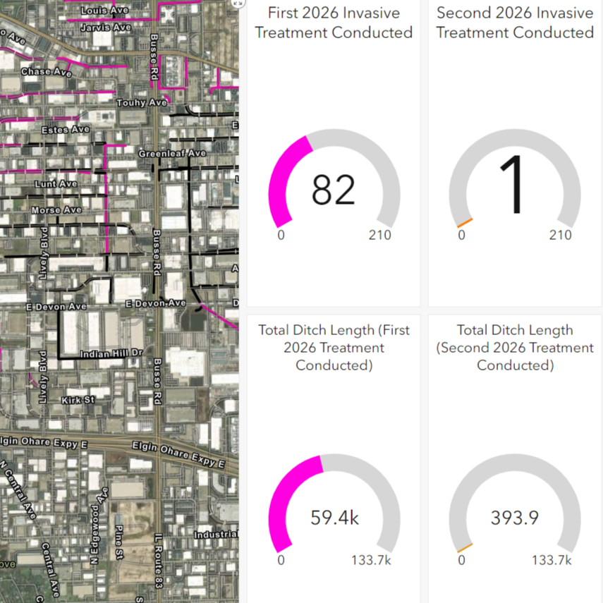
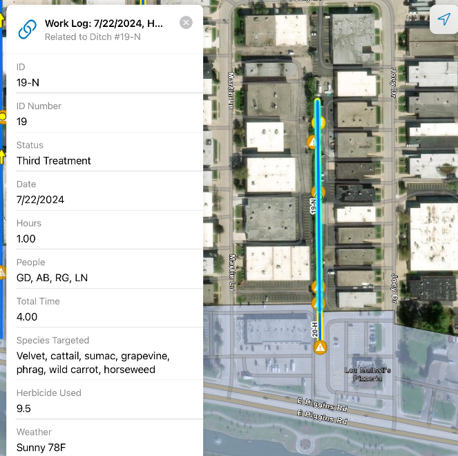
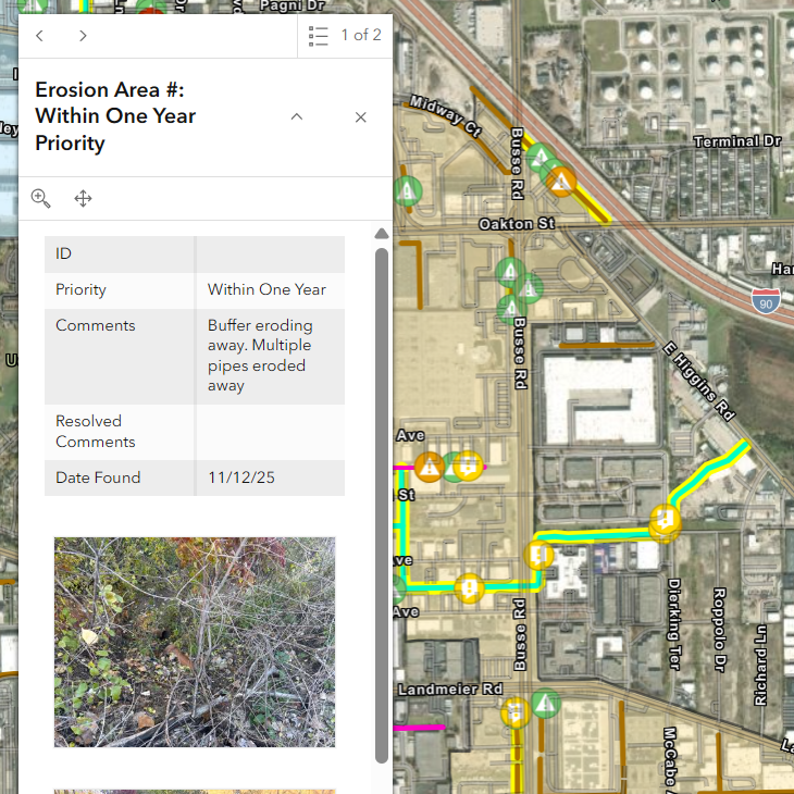
ASSET MANAGEMENT
Bringing Infrastructure Information Together
GIS allows communities to combine maps, records, images, and condition data into one centralized system accessible from the office or the field. This improves efficiency while providing real-time insight into infrastructure assets.
Applications Include:
- Utility inventories
- Pavement management
- Sidewalk inventories
- Condition assessments
- Mobile field access
- Asset tracking and reporting
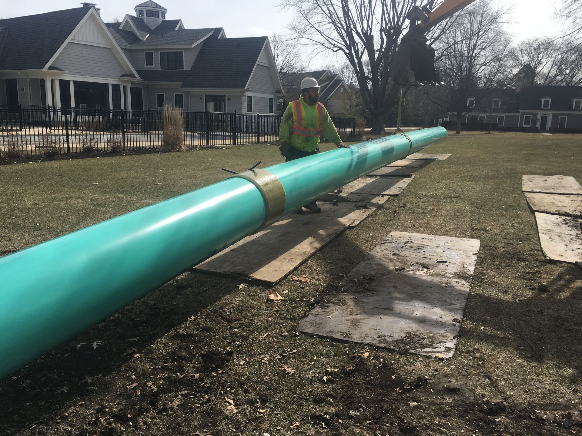
UTILITY MAPPING
Improving Visibility Across Utility Systems
Knowing where infrastructure is located is critical for maintenance, emergency response, and future improvements. GIS mapping provides quick access to accurate information that supports efficient operations.
Services Include:
- Water system mapping
- Sanitary sewer mapping
- Storm sewer mapping
- Pipeline mapping
- Infrastructure inventories
- Location services and support
specialty
Using GIS to Support Planning and System Analysis
Once infrastructure data is organized and mapped, communities can leverage GIS to evaluate performance, prioritize improvements, and plan for future growth. GIS becomes much more than mapping, it becomes a decision-making tool.
HLR integrates GIS data with engineering analysis to help clients better understand how their systems function and where investments will provide the greatest benefit.
Capabilities Include:
- Stormwater master planning
- Utility system modeling
- Water system evaluations
- Infrastructure analysis
- Conflict identification
- Long-term capital planning support
DATABASE DESIGN
Building Reliable Foundations for Long-Term Data Management
Effective GIS systems depend on well-structured databases. HLR develops customized databases that organize and maintain critical information, allowing communities to access and manage data efficiently for years to come.
Services Include:
- Database design and deployment
- Data organization and migration
- Custom attribute development
- System maintenance
- Data updates and support
- Integration with existing workflows
TECHNOLOGY & SUPPORT
Delivering Solutions That Grow With Your Community
Successful GIS programs require more than software. HLR works closely with clients to understand their goals, implement practical solutions, and provide ongoing support as needs evolve.
Our team provides setup, maintenance, analysis, training, and technical support while utilizing industry-leading tools including ArcGIS, ESRI applications, AutoCAD, and MicroStation.
Helping Communities Become More Connected and Efficient
TRUSTED EXPERTISE
Smarter Asset Management
Helping agencies organize and access critical infrastructure information.
Better Planning
Supporting data-driven decisions for maintenance and capital improvements.
Integrated Solutions
Combining GIS with engineering, surveying, and utility expertise.
Long-Term Support
Providing implementation, training, and ongoing system maintenance.
get started
Ready to Turn Information Into Insight?
Partner with HLR to develop GIS solutions that improve asset management, enhance decision-making, and support smarter infrastructure investments.